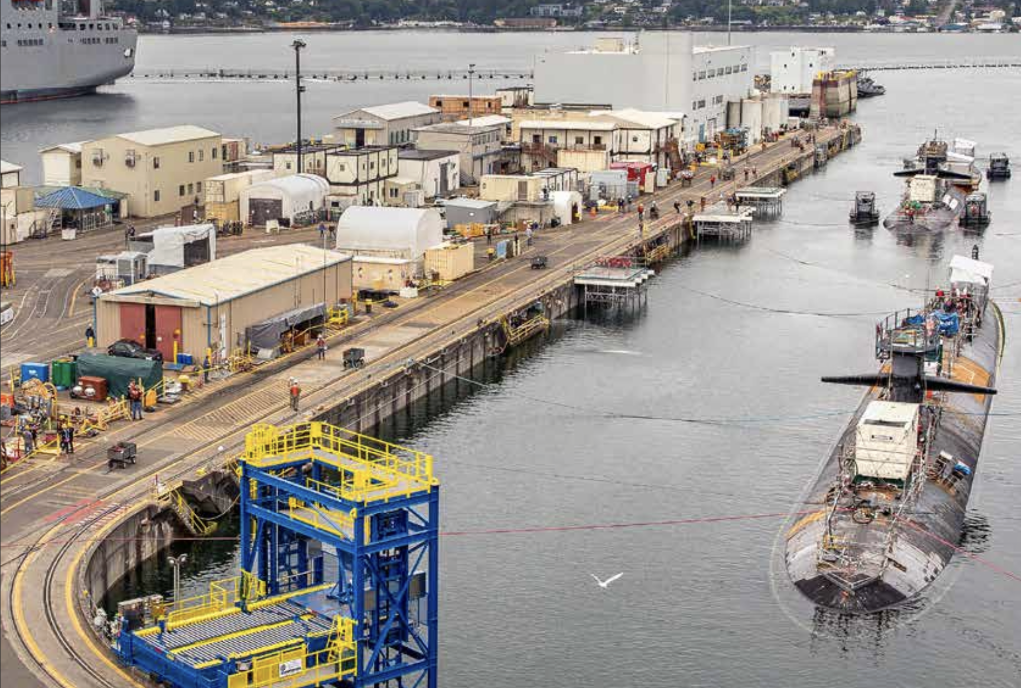
SAN DIEGO – The Navy started work on two Washington state submarine dry docks that the service shuttered last month over fears of earthquake damage, USNI News learned.
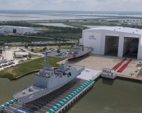
Late last month, the service closed four dry docks – three at Puget Sound Naval Shipyard & Intermediate Maintenance Facility in Bremerton, Wash., and the delta pier at the Trident Refit Facility in Bangor, Wash.
On Feb. 10, the Navy issued $76.35 million task order to Kiewit-Alberici SIOP MACC JV “for the rapid implementation of recommended courses of action based on concurrent existing conditions assessments at three dry docks in Puget Sound Naval Shipyard and Intermediate Maintenance Facility, and Naval Submarine Base Bangor,” according to a Thursday announcement. The maximum amount is capped at $80 million.
“Construction material started arriving at Puget Sound Naval Shipyard and Intermediate Maintenance (PSNS & IMF) on Saturday, Feb. 11, with mitigation efforts commencing Feb 15,” reads a Navy statement provided to USNI News.
“The ongoing work supports one dry dock each at PSNS & IMF and the Trident Refit Facility – Bangor.”
A defense official told USNI News the service had started work on dry dock four at Puget Sound and in Bangor and the work is expected to finish by the end of March. The contract announcement said the whole project would finish by May.
USNI News understands the concern was rooted in the potential for the dry docks to collapse in the event of an earthquake or tsunami and how it could damage submarines under repair. The fixes would reinforce the walls of the dry docks to mitigate the risk, a defense official confirmed to USNI News.
The work could include removing the floor and sides of a dry dock or using different types of sand to absorb motion if an earthquake occurs, USNI News understands.
All four dry docks have been operational for decades, but an evaluation of the facilities last year raised unspecified risks to submarines that are under repair, the service said last month.
“We’re getting ahead of the problem,” Secretary of the Navy Carlos Del Toro told reporters Thursday at the WEST 2023 conference, co-hosted by the U.S. Naval Institute and AFCEA.
“The fact is that [we’re] able to reinforce those dry docks today so that they can go on and be operational for that many more years afterwards. It’s the right way to do things.”
Del Toro tied the work on the dry dock to a larger initiative in the Department of the Navy that is taking a broader look at infrastructure across the Navy and Marine Corps.
“This is about addressing the worst problems first so that they don’t become catastrophic. It’s about trying to minimize risk across the entire spectrum of investments that have to be made,” Del Toro said.
“The work that we’re doing in Puget Sound right now is the perfect example of that. I mean these were analyses that were done several years ago now to take a look at the structures of all our dry docks basically and try to determine where challenges may present themselves, especially with increased seismic activity in the Puget Sound area.”
The effort will prioritize investments based on data from a department-wide survey of bases and facilities, Del Toro said.
Earlier this month, Del Toro described the dry dock closures as the result of “planned assessments” and some additional evaluations for the Navy’s Shipyard Infrastructure Optimization Plan, or the service’s effort to overhaul the public yards.
“There were issues that were revealed that needed our attention in terms of mitigating and strengthening those dry docks, in the event that we have the highest type of earthquake and seismic activity to prevent failure of the dry docks,” Del Toro said at a Feb. 1 symposium hosted by the American Society of Naval Engineers.
When pressed by USNI News on what new information the Navy learned about the seismic risk to the dry docks, Del Toro declined to provide details.
“I’m not going to go into the technical details of exactly what they found, but we’re addressing each and every one of those things to help” reduce the risks, Del Toro said.
In 2022, a new set of tsunami hazard maps for Puget Sound came out showing potential scenarios should an earthquake occur from the Cascadia subduction zone or the Seattle fault line, Carrie Garrison-Laney, a coastal hazards specialist at the University of Washington’s Washington Sea Grant, told USNI News. The Cascadia subduction zone is offshore but poses a risk to the surrounding area, including where the shipyards are located.
“That’s the one that’s likely … to generate the largest earthquake with the worst tsunami that will affect the largest amount of coastline,” Garrison-Laney said.
“It’s been known for a while that Cascadia tsunamis, even though they’re generated, you know, far offshore, on the Pacific coastline, the tsunamis will still come into through the Strait of Juan de Fuca and make it down into Puget Sound. And there are a few places in Puget Sound where the modeling shows that the tsunami hazards will be greater there than in other places.”
Cascadia was the source of the 2001 Nisqually earthquake, but it has also led to larger earthquakes, like the one in 1700 that experts estimate was a 9.1 to 9.2 on the Richter scale. That earthquake caused a tsunami that reached parts of Japan.
“We have a long record of earthquakes on this fault now, and it produces magnitude 9 or greater earthquakes, we think about on average every 500 years,” Brian Sherrod, a research geologist with the U.S. Geological Survey, told USNI News.
The other potential source of an earthquake in the region is the Seattle fault line, which had its last large earthquake approximately 1,100 years ago. That earthquake also caused a tsunami and there’s geological evidence of that on the Sinclair Inlet in Puget Sound, according to Garrison-Laney said.
“It causes tsunami hazards to a more limited area than Cascadia does,” she said of the Seattle fault. But when using higher resolution digital elevation models, more hazards are evident.